
Palolo Neighborhood Board No. 6
About the Palolo Neighborhood Board
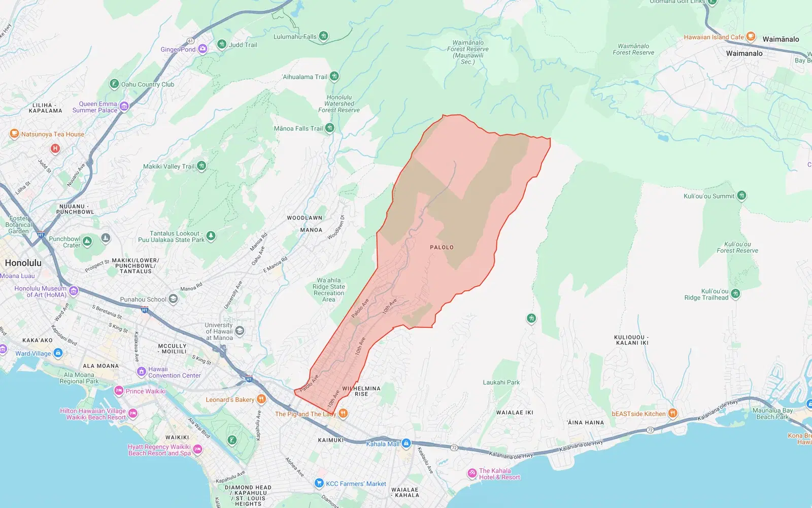
Covers the Pālolo Valley area from Waiʻalae Iki Ridge to Waiʻalae Avenue. Includes Pālolo, Kaimukī Heights, and the Pākuʻi Street vicinity.
We summarize these lengthy meetings so you can stay informed about zoning changes, infrastructure updates, public safety concerns, and community decisions that affect residents and property owners in Palolo.
Monthly Summaries
- 2026-07-10 – No 06 Pālolo Neighborhood Board Regular Meeting July 2026
- 2026-05-14 – No 06 Pālolo Neighborhood Board Regular Meeting May 2026
- 2026-02-13 – No 06 Pālolo Neighborhood Board Regular Meeting February 2026
- 2025-12-13 – No 06 Pālolo Neighborhood Board Regular Meeting December 2025
- 2025-11-13 – No 06 Pālolo Neighborhood Board Regular Meeting November 2025